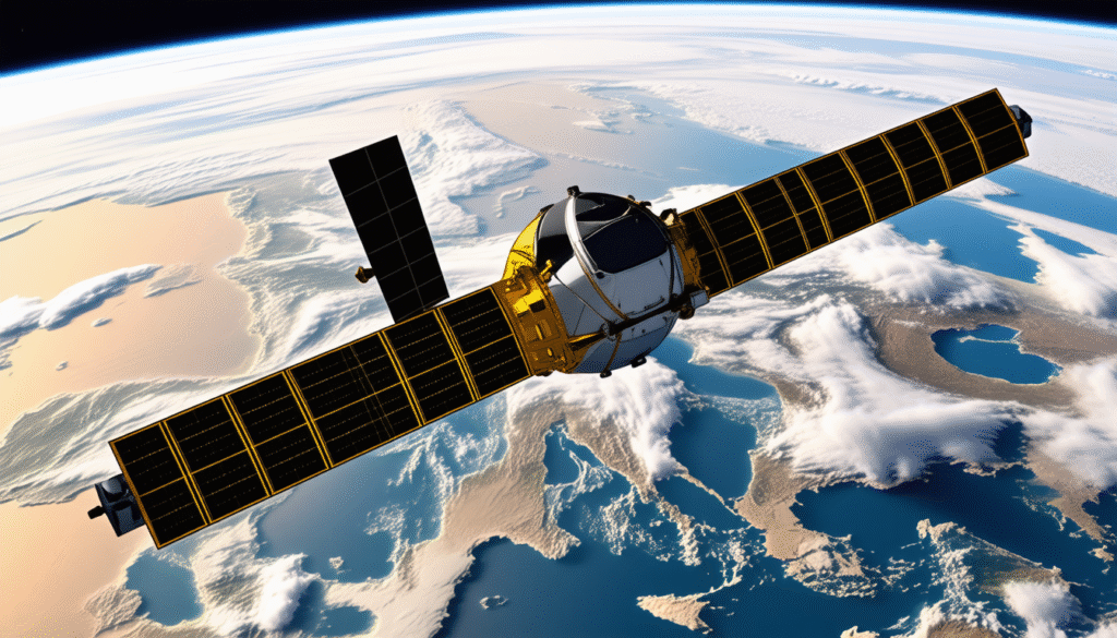
The launch of Europe’s first satellite marked a monumental chapter in aerospace history, heralding a new era where European nations decoded the mysteries of Earth from space. Far from just a technological milestone, it represented a collective leap towards space sovereignty, scientific discovery, and industrial prowess. This endeavor, culminating in the early 1990s with the successful deployment of the European Remote-Sensing Satellite (ERS-1), galvanized European confidence and ambitions in space exploration, setting foundations for future programs such as the Copernicus Earth observation network and Galileo global navigation system. Notably, while many satellites before it heralded the dawn of space as a domain for superpowers, ERS-1 carried Europe’s distinct signature—cutting-edge radar technology capable of peering through clouds, fog, and darkness. This capacity transformed satellite imagery and environmental monitoring, expanding horizons from meteorology to oceanography and climate science. As the satellite circled the Earth in a flawless polar orbit, its data streams energized an array of activities from wind assessments over vast seas to tracking oil spills with unprecedented precision.
Venturing beyond scientific laurels, the ERS program catalyzed a robust European aerospace industry powerhouse, led by aerospace giants like Airbus Defence and Space. The collaboration of over 50 companies across 14 nations underscored Europe’s commitment to pooling expertise, knowledge, and resources, nurturing innovation pipelines that continue to thrive in 2025. This milestone showcases Europe’s quest for independence from foreign launch providers and satellite systems—an ongoing narrative linking Ariane and Vega launchers with Intelsat and Skynet communication satellites. The legacy of ERS-1 remains unmistakably vital in defining Europe’s identity in space, reflecting an exemplary blend of international cooperation, technological advancement, and environmental stewardship. Moreover, this saga invites reflection on the broader transformations that space technology has imposed on geopolitics, commerce, and even daily life, as technologies born from pioneering satellites now underpin navigation, security systems, and emergency responses globally.
The Dawn of European Space Ambitions: ERS-1’s Groundbreaking Mission
The European Remote-Sensing Satellite 1 (ERS-1) was unleashed into orbit on July 17, 1991, from the Guiana Space Centre in Kourou atop the trusted Ariane launcher. Weighing about 2.4 tonnes and stretching nearly 12 meters when deployed, it was Europe’s first serious step into space-based environmental monitoring. More than just a launch, it reflected the continent’s strategic vision to harness space for Earth observation and climate research.
At its operational height of 785 kilometers, ERS-1 carved a polar orbit that made it cover every point on the globe approximately every 100 minutes, scanning vast 4,000-kilometer-long strips along a 100-kilometer-wide swath of Earth’s surface in each pass. Equipped with a highly sophisticated radar system operating in the C-band (5.3 GHz), ERS-1 delivered images with a spatial resolution of around 30 meters, a remarkable feat enabling scientists to study minute surface details invisible before. This radar capability was especially revolutionary as it pierced through cloud cover and darkness, dramatically increasing the satellite’s usability, unlike optical sensors that are often hampered by weather and daylight conditions.
Key features that highlighted ERS-1’s instrumental value included its:
- Imaging Synthetic Aperture Radar (SAR) to map land, coastline, and ice.
- Radar Altimeter to measure ocean surface height variations critical for understanding tidal and wave dynamics.
- Microwave Radiometer which assessed ocean surface temperatures and helped gauge wind speeds over vast bodies of water.
During its unprecedented mission life of nearly a decade—far beyond the three-year expectancy—ERS-1 amassed over 1.5 million images and completed approximately 45,000 Earth orbits. This continual output drastically enhanced meteorological models, improved marine navigation, and contributed to monitoring environmental events like the El Niño warming phenomenon. The satellite’s data empowered meteorologists worldwide to better anticipate weather patterns, and it caught illegal marine polluters in the act, demonstrating spaceborne technology’s role in enforcement and environmental protection.
Collaboration Across Borders and Industry
The ERS-1 project was not just a triumph of aerospace engineering but also a shining example of European unity. Over 50 companies spread over 14 nations contributed, under the industrial leadership of Airbus Defence and Space. This collaboration signaled the continent’s willingness to share expertise and resources, heralding a new model of space program development driven by multinational consortia rather than individual national efforts. The ERS program’s success spawned a slew of satellite development initiatives, enriching Europe’s aerospace ecosystem with robust industrial capacities that rose in sophistication and geopolitical relevance through the following decades.
This model fostered an environment where technologies such as the Eurostar spacecraft platforms—used by communication giants like Eutelsat and Inmarsat—and launch vehicles including the Ariane and Vega rockets, could be refined and advanced. Through this intricate network, Europe fortified its ability to operate independently from dominant powers like the USA and Russia, matching the scale and ambition of their space undertakings.
- Enhanced Europe’s industrial space cooperation and technological foothold.
- Laid groundwork for future Earth observation programs like Copernicus.
- Enabled the rise of reliable European launch solutions such as Ariane and Vega.
- Facilitated integration with global satellite communications via Skynet and Intelsat networks.
Scientific Impact and Environmental Innovations from ERS-1
Before ERS-1, satellites primarily used optical imaging technology, plagued by limitations from weather and lighting. The advent of spaceborne radar with ERS-1 changed the rules. Its synthetic aperture radar provided scientists with continuous, high-resolution images regardless of time or climatic conditions. This innovation opened pathways to new realms of Earth science, especially in monitoring the cryosphere, oceans, and atmosphere.
With its radar, ERS-1 revealed:
- Secret details of the Arctic Ocean floor beneath shifting ice sheets, helping scientists understand polar geology and glaciology.
- Oil pollution detection by identifying ships dumping waste illegally—games needed to catch polluters red-handed on vast, often murky oceans.
- Wind speed and direction measurements over oceans, crucial data for weather forecasting and hurricane tracking.
- Monitoring of ocean currents and temperature changes, important for tracking climate cycles like El Niño.
These capabilities enriched climate science, supporting international efforts to decode Earth’s complex systems. For instance, radar interferometry employed during tandem missions with ERS-2 allowed the generation of high-definition terrain maps and millimeter-precision surface deformation tracking—valuable tools for earthquake and volcanic activity research. In essence, ERS-1 did not just watch Earth; it empowered humanity to understand and protect it better in real-time.
From ERS-1 to Modern Satellite Environmental Monitoring
The legacy of ERS-1’s technological breakthroughs paved the way for successors such as Envisat—the largest Earth observation satellite launched in 2002—and the MetOp meteorological satellites, which herald new dimensions in space-based environmental monitoring. European programs now operate under comprehensive initiatives like Copernicus, a flagship project offering consistent surveillance of land, oceans, atmosphere, and emergency response, among six key domains. The Copernicus program epitomizes the strategic importance of Europe’s self-sufficiency in satellite data, employing Sentinel satellites as pivotal agents of global environmental stewardship.
- Integration of multiple sensor technologies to enhance observation capabilities.
- Provision of near real-time data supporting disaster management and security operations.
- Contributions to climate change research through precise greenhouse gas measurements.
- Innovation ecosystem stimulating aerospace technology growth across Europe.
Technological Trailblazing: Radar and Microwave Innovations from ERS-1
ERS-1’s success was deeply rooted in its revolutionary radar and microwave instrumentation. It was the first European satellite to integrate a radar system designed specifically for Earth observation in the C-band, a technology that allowed continuous surface imaging unaffected by atmospheric conditions. The 5.7-centimeter wavelength radar system harnessed the synthetic aperture radar technique, enabling image resolutions approximately 30 meters across vast geographical extents.
The satellite’s microwave radiometer complemented this by measuring ocean surface temperatures and enabling wind speed estimations on the sea, which dramatically enhanced meteorological forecasting. These technologies combined provided an unmatched global perspective, crucial for comprehending ocean-atmosphere interactions and their impact on climate phenomena.
- Radar Altimeter: Allowed precise ocean wave measurements and sea surface height monitoring.
- Synthetic Aperture Radar: Enabled imaging regardless of sunlight or cloud presence.
- Microwave Radiometer: Provided essential data on oceanic temperatures influencing weather models.
- Tandem operations with ERS-2: Introduced radar interferometry that visualized minute changes in Earth’s terrain.
This combination was a giant technological leap that set standards replicated in subsequent radar satellites, including Europe’s own MetOp and Sentinel missions. The impact continues to resonate today as meteorological agencies and environmental scientists rely heavily on data emanating from spaceborne radar systems.
Enduring Influence on Europe’s Aerospace and Satellite Networks
The pioneering ERS-1 laid the cornerstone for Europe’s contemporary satellite capabilities and aerospace industry growth. Its launch invigorated further development of satellites within programs employing the Eurostar platform, which powers communication satellites for companies such as Eutelsat and Inmarsat, extending Europe’s reach into global telecommunications. The Ariane and Vega launch vehicles, partly motivated by ambitions instigated during the ERS-1 era, now routinely serve satellite deployment needs, ensuring Europe’s independent access to space.
The success of ERS-1 also influenced the strategic deployment of satellites within Europe’s Skynet defense communication network and facilitated integration with commercial constellation operators like Intelsat. The positive ripple effects extended to navigation systems too; Galileo, Europe’s own global navigation satellite system, benefits from technological maturity and expertise seeded by pioneering missions.
Key impacts on the European space landscape include:
- Establishment of a robust industrial base for satellite construction and operation.
- Enhancement of Europe’s autonomous access to space via Ariane and Vega rockets.
- Support for critical infrastructures such as Copernicus environmental satellites and Galileo navigation.
- Enabling commercial satellite services via key platforms like Eurostar satellites serving global data transmission.