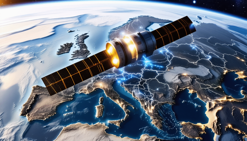
Navigating through the bustling streets of modern Europe or the vast oceans that cradle its shores, pinpoint accuracy is no longer a luxury—it’s an absolute necessity. Since the dawn of satellite navigation, the world has relied on a few key players, but in 2025, the stage highlights Galileo, Europe’s very own answer to global positioning challenges. Born under the auspices of the European Space Agency (ESA) and nurtured by the European Union Space Programme, Galileo has blossomed into a vital tool that offers not only remarkable precision but also a promise of independence in satellite navigation for millions of users.
With a constellation of 28 satellites orbiting some 23,222 kilometers above the Earth in meticulously planned paths, Galileo’s reach extends to the northernmost points of Europe and beyond. This system’s harmonious dance with its American and Russian counterparts—GPS and GLONASS, respectively—makes it a powerful contender in the complex realm of global navigation satellite systems (GNSS). But Galileo’s allure doesn’t stop at mere coverage. It presents a multifaceted set of services spanning across everyday consumer products, emergency response frameworks, and innovative industrial applications, all while fueling Europe’s ambition to stake its claim in the global GNSS market estimated to be worth an eye-watering €175 billion. Intrigued by the subtle, precise workings of this technological marvel? Let’s dive deeper.
Galileo’s Navigation Mastery: Precision and Reach in Global Positioning
At the heart of Galileo’s acclaim lies its exceptional positioning accuracy. Unlike traditional satellite systems relying on a single frequency for signals, Galileo employs dual-frequency signals as a standard, slashing real-time positioning errors down to a remarkable one-meter range. This level of precision is not mere trivia; it fundamentally transforms how everything from smartphones to autonomous vehicles plot their journeys.
The system’s 28 satellites orbit Earth in three groups situated in medium Earth orbit (MEO) planes. These orbits are carefully inclined at 56 degrees to the equatorial plane, enabling coverage that is robust even at extreme latitudes—up to approximately 75 degrees north. Thanks to this, explorers navigating the windy cliffs near Norway’s North Cape, for instance, can rely on Galileo to keep their bearings steady.
The constellation’s design includes a strategic buffer: three active spare satellites per orbital plane. This redundancy means losing a satellite doesn’t translate into gaps or degraded service—a crucial attribute for both civilian and professional users who demand constant reliability. Even the two satellites that ended in non-operational orbits due to a launcher error still serve a noble purpose by aiding in the Search and Rescue (SAR) function, exemplifying efficient resource use.
- Dual-frequency signals enhance accuracy and robustness.
- Coverage extends well beyond Europe, up to 75 degrees latitude north.
- Redundant satellites maintain system reliability and resilience.
- SAR functionality plays a critical role in emergency situations.
By delivering such levels of dependability, Galileo doesn’t just challenge existing GNSS stalwarts; it elevates the standards for positioning services worldwide.
Ground Infrastructure and Control: The Backbone of Galileo’s Success
Behind the celestial choreography of satellites lies an intricate terrestrial network ensuring the system operates flawlessly and securely. Two primary Galileo Control Centres (GCCs), located strategically in Europe—one in Germany near Oberpfaffenhofen and the other in Fucino, Italy—serve as nerve centres managing satellite operations and the dissemination of navigation data.
These centres process data transmitted by a world-wide web of Galileo Sensor Stations (GSSs), which monitor satellite signals and environmental conditions. Data flows through a highly resilient, redundant communications network to ensure uninterrupted operations. This comprehensive monitoring allows for continuous adjustments and synchronization of satellite clocks with the ground station time standards—a critical operation given that even nanosecond discrepancies could mean meters of error in positioning.
Integral to Galileo’s integrity is its unique signal authentication service, which safeguards signal authenticity against spoofing or interference—a growing concern in satellite navigation security. This authentication service positions Galileo as a guardian of trust in an era where precise and verified location information is vital for sectors like banking, critical infrastructure, and public safety.
- Two central control centres coordinate satellite commands and manage navigation services.
- Global sensor stations continuously monitor satellite health and signal integrity.
- Redundant networks minimize risk of communication failure.
- Signal authentication enhances security and trust.
Such robust ground infrastructure enables Galileo to offer not only positioning but also reliability and trust in a world increasingly dependent on satellite navigation data.
Galileo’s Unique Services: From Everyday Use to Life-Saving Applications
While Galileo seamlessly integrates into everyday gadgets like smartphones and car navigation systems, its offerings extend to a remarkable suite of services catering to specialized needs. Among these, the Search and Rescue (SAR) service stands out—not just for relaying distress signals to rescue operators, but also for its pioneering feature that sends a confirmation back to the user, assuring them that help is on the way. This feedback loop is a major advancement over previous systems and has already saved countless lives.
Moreover, Galileo’s services span:
- Open Service (OS): free, high-precision positioning information for public use.
- High Accuracy Service (HAS): enabling up to 20 cm accuracy for professional demanding applications like precision farming and surveying.
- Signal Authentication Service (SAS): protecting users against fake or manipulated signals.
- Search and Rescue (SAR): globally coordinated emergency alerting and response.
For critical public safety operations, Galileo’s guaranteed availability under civilian control makes a substantial difference. Emergency services, transport sectors, and even financial transaction systems that rely heavily on timestamp accuracy benefit from such reliable signals. Additionally, industries like agriculture and rail transport leverage Galileo’s precision and timing to optimize operations, enhancing sustainability and ecosystem preservation through smarter resource use.
By continuously innovating, Galileo catalyzes Europe’s competitive edge in the global GNSS market, fostering the creation of novel applications and opening avenues for entrepreneurial pursuits, reflecting the system’s role as an enabler of European technological sovereignty.
Preparing and Testing: The Road to Fully Operational Galileo
Launching a satellite constellation is no small feat, and Galileo’s journey started early with the experimental GIOVE-A and GIOVE-B satellites launched in 2005 and 2008, respectively. These precursors validated critical technologies, such as signal transmission and satellite clocks, while ensuring that Europe secured specific frequency allocations crucial for uninterrupted operations.
One fascinating takeaway from these experimental missions was the detailed observation of the radiation environment in Medium Earth Orbit—a harsher space domain than low Earth or geostationary orbits. Understanding these conditions was pivotal for designing components robust enough to thrive in this challenging space neighborhood.
The operational phase kicked off in 2011 and extended across the decade as satellites were progressively launched to construct the constellation. Initial operational capability was declared in 2016, marking the transition from experimental to active service provision. Since then, continuous improvements and expansions have broadened Galileo’s functionalities, aligning it with user demands and technological advancements.
- Experimental satellites tested critical Galileo technologies and secured frequencies.
- Operational satellite launches between 2011 and 2025 built the full constellation.
- Understanding space radiation helped in crafting robust satellite systems.
- Continuous deployment ensures Galileo evolves with emerging needs.
Galileo’s Impact on European Innovation and Global GNSS Cooperation
Galileo’s influence stretches far beyond navigation. By providing Europe with an independent satellite positioning infrastructure, it anchors the continent’s technological autonomy and sovereignty in a domain traditionally dominated by the United States and Russia. This independence translates into strategic benefits for European security, technological innovation, and economic growth.
The system’s interoperability with other global constellations, like GPS and GLONASS, boosts overall positioning reliability and availability for users worldwide, enabling a smoother constellation-scale navigation experience. This international cooperation reflects a pragmatic approach to global navigation challenges, while maintaining distinct civilian control grids.
Furthermore, Galileo stimulates a burgeoning European GNSS industry ecosystem, from the production of advanced user receivers integrated into commercial and consumer electronics to the development of sophisticated software tools such as the SatNav Toolbox and the Galileo Test User Segment, which empower developers and researchers to experiment with and refine satellite navigation technologies.
- Galileo ensures European independence and sovereignty in satellite navigation.
- Supports multi-constellation cooperation for enhanced global coverage.
- Drives innovation, job creation, and new market opportunities within Europe.
- Supplies developers with tools to advance GNSS applications and security.
As a key player in the global GNSS arena, Galileo epitomizes Europe’s ambition to not merely participate but lead in shaping the future of satellite navigation, with rippling effects across public services, industry, and everyday life.